Wednesday, February 24, 2016
Nunckatesset Greenway project
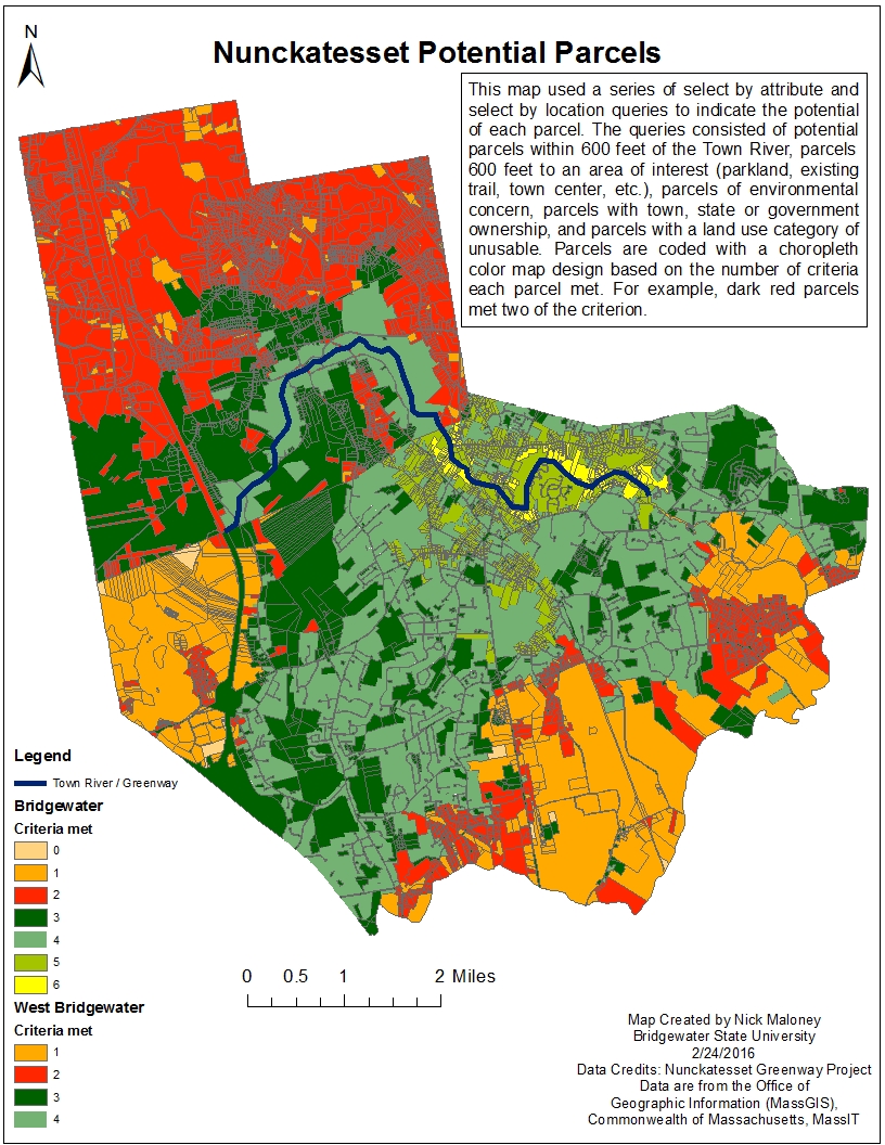
Below is a map created in ArcMap desktop version. In this map making process a series of select by attribute and select by location queries were built to identify potential parcels for the Nunckatesset Greenway trail project.

Wednesday, February 17, 2016
Bristol, Plymouth, and Barnstable Counties
This map was created in ArcMap desktop version. It focuses on the population demographics of three South-East counties: Bristol, Plymouth, and Barnstable counties.


Mediterranean Cruise
Below is a map I created using ArcGIS online. It displays various ports I visited on a Mediterranean cruise in May 2015. Two of the most interesting places I stopped on the cruise were the ancient Vatican City and the ancient city of Pompeii. I also generated a QR code for a shortcut to the map, if you have a smart phone with a QR scanner give it a try.

Wednesday, February 10, 2016
Massachusetts Population
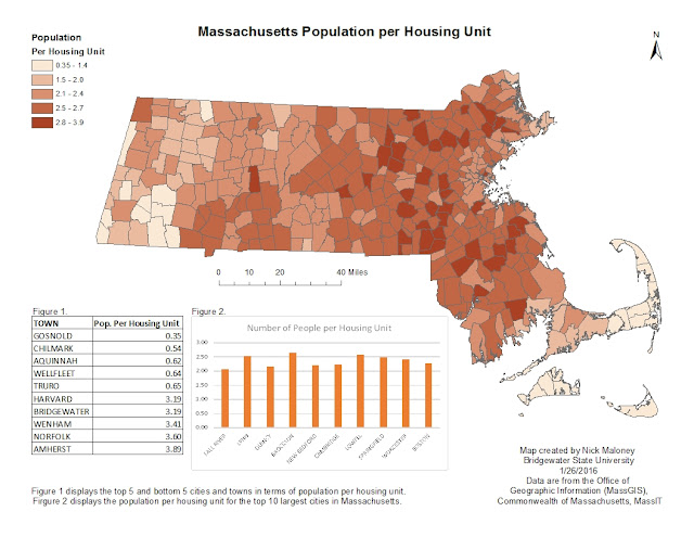
Below is a map I made in ArcMap desktop version. It displays Population density for each town in Massachusetts using a choropleth map. The table to the lower right displays the top 5 and bottom 5 cities in terms of population. The bar graph the the lower right displays the top 10 most populated cities in Massachusetts.

Monday, February 8, 2016
UFO Sightings in the U.S.
Below is a brief map I made in ArcGIS online. It displays recorded UFO sightings in the United States. The data is from an excel file I extracted from Wikipedia.
Subscribe to:
Posts (Atom)